

The Challenge of Increasing Water Supplies
Background Information Many areas in the United States and Europe are currently experiencing water deficits that result in restrictions places on water use and in some cases prevent the development of lands. There are many techniques available to increase water supplies: more wells, impounding surface waters, treating and reusing wastewater, and conservation. Using a topographic map of an area, students will analyze the suitability of a site for dam construction and will develop an impact analysis of the probably effects of altering the flow patterns of the waterway. The evaluation of a site for suitability for the construction of a dam requires: Appropriate topography (enough elevation change to create a storage basin) Environmental issues likely to arise include: Disruption of wildlife habitats, especially loss of wetlands
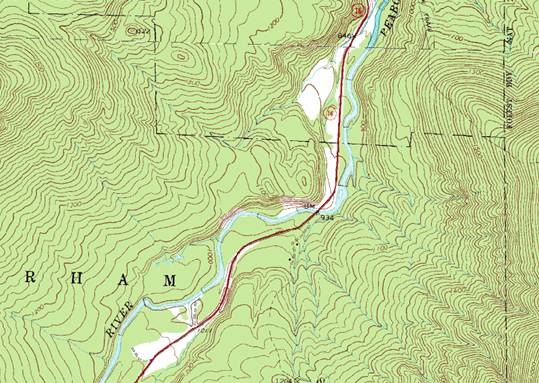
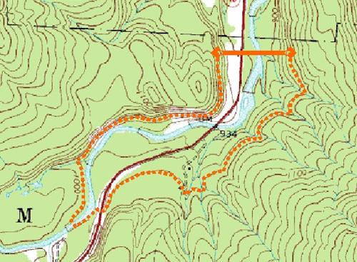
Using a United States Geological Survey Topographic Quadrangle (USGS Quad; available from TOPOZONE for the United States and as ordinance surveys for much of Europe), evaluate a chosen reach of the river for suitability of dam locations. Methods: 1. The area with the greatest topographic relief, that which allows for the greatest storage volume and an increase in storage area of 15 meters (45 feet). Figure 1 shows two sites, one with steep slopes that would allow for dam construction, the other with little change in elevation, requiring an impracticable length of dam. After finding the steepest site, draw in the dam, extending it perpendicularly to the river until you reach the required height (see Figure 2).
Figure 1 Topography suitable to dam construction. Steep slopes on both sides of the river will allow for a confined storage basin and a dam of reasonable length
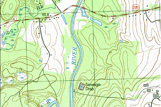
2. Using the topographic lines on the map, draw in the area that would be flooded following dam construction (Figure 3). Using graph paper as an overlay, measure the surface area of the reservoir created. Count the number of structures and roads and the area of agricultural, forest and other open space that would be flooded.
Figure 3. Extent of flooding for a dam with a 15 m maximum depth (site shown on Figure 1).
3. Identify any wastewater treatment plants or urban centers located above the dam. Questions: 1. Using the formula below, determine the amount of water potentially stored by the dam. If the residents of the area require 500 liters of water per day during the dry season, how many people could be supported by the dam assuming that no rain fell for one month? Use meters for all measurements; 1 cubic meter of water equals 1000 liters. Volume of water stored (meters3) = (1/2 * widest point (W) * length (L)) * (1/3 * (depth (D)/2))
2. If each house lost to the reservoir is valued at $250,000, what would the cost of structures be for the construction of the dam? 3. Assume that land values in your area are approximately $100,000 per hectare (or correct for a more accurate value for your area) and that agricultural lands are worth approximately 50% of residential land. What is the value of the land lost to the reservoir? |
|